What is Global Daytime Population Density?

Global Daytime Population Density gives information about the size of population that is present in a given area during the day
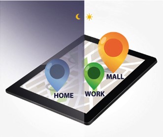
The population within an area is defined by official statistics as the number of residents being registered in that area. This refers to nighttime population, consisting of permanent residents. On the other hand there is the daytime population, consisting of the number of people who are present in an area during the day. It includes, among others, consumers, tourists, workers and residents. Yet there are two different types of populations for any given area. This is an important difference, especially for organizations that want to find out where people are during the day, rather than where they live.
Despite official statistics, many parts of the world have populations that vary wildly from day to night. The daytime population in most areas increase substantially during the day, particularly those that have a workforce coming into the area for work and then commuting elsewhere at the end of the day.
Advantages
- Globally consistent and comparable
- Gives a true representation of where people are located during an average day
- The data is subjected to a strict quality control and constantly updated
Vast variety of uses in many different aspects of business applications
Global Daytime Population Density Data helps companies with:
- Predicting best retail locations
- Human Resource Planning
- Better understanding of industrial area population
- Logistics
Global Data Levels
- Postcode (zip) level
Worldwide postal areas are geographic boundaries that define the geographic area for each postcode. Allowing the subdivision of larger administrative areas (larger cities). - Administrative Area Level
Municipality boundaries plus the higher levels like provinces and state boundaries. - Small Area Levels
Could be subdivisions of the postcode or administrative boundaries like census areas. The lowest level of geographical boundaries we have currently available.
Daytime and Nighttime Population
Methodological Notes
Calculated by using a multitude of variables:
- Total current resident population of a given area
- The number of workplaces, secondary home, POIs and other
regular locations - Internal migration based on the change of the residences
within an area
| - Cross-border migration based on the regular travels
between different countries - Accessing temporary population statistics
- Assessing temporary population (hourly, daily, weekly,
monthly, etc.)
|
Available Data Formats
| Standard data formats | Standard GIS formats |
- Tab delimited file (.txt)
- Access database (.mdb)
- Excel (.xls)
| - Esri Shape file (.shp)
- MapInfo (.tab)
- Geopackage
- Spatiallite
- GeoJSON
|
Brochure
Contact
We offer worldwide boundaries and geo data to gain knowledge on geographical situations. Please contact Erik van Hunnik for more information via +31 15 219 0885 or send an mail to erik.vanhunnik@firstelement.nl)